


| Client | : State Hydraulic Works (DSI) 17th Regional Directorate, Van |
| Province | : Muş |
| Location | : Bulanık Malazgirt |
| Survey | : 1/25 000 – 1/5000 – 1/1000 Scale |
| Project’s Goal | : Flood Planning and Protection |
Bulanık and Malazgirt District of Muş, Murat River and Tributaries of Murat River Flood and Sedimentation Control Planning and Detailed Design Project Engineering Services
| River | : Murat River and Tributaries of It |
| Basin Area | : 10 717 km2 |
| Whole Project Length | : 70 000 m |
| Proposed Type |

Hydrological studies
Land Expropriation study
Geotechnical Survey and Natural
Construction Materials Survey
Environmental impact assessment report
Planning Report and detailed design
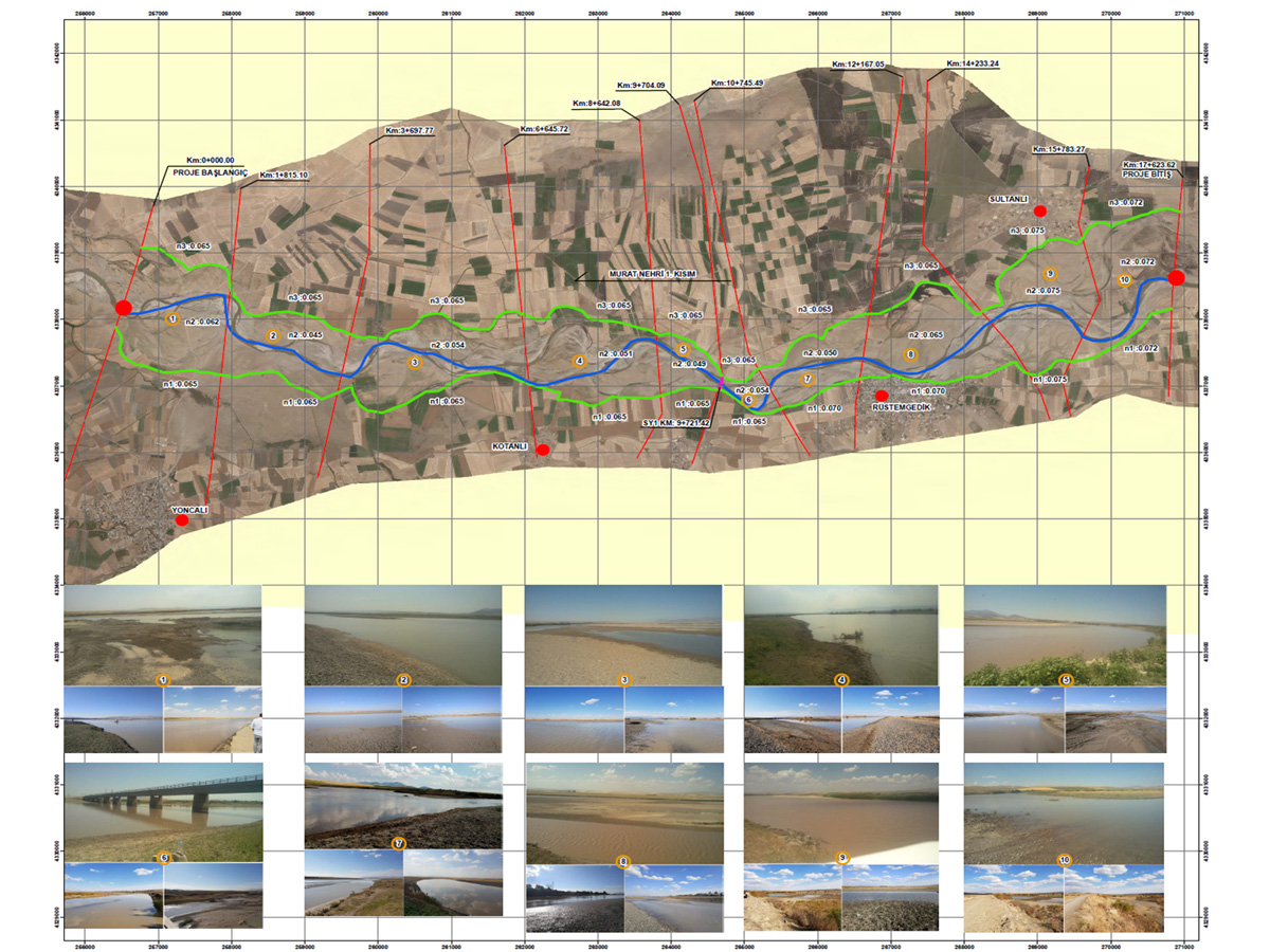
Murat River starts its flow from Diyadin district of Ağrı, north of Lake Van. The river is formed by the merging of branches from Aladağ and Muratbaşı Mountain. The 64.10 km section of the main branch of the Murat River, which is planned to be rehabilitated, continues to flow in the north-south-west direction.
It has been determined that the hydraulic capacity of the Murat River is quite limited due to the low slope of the bed and high roughness factors. Alternatives have been developed by considering factors such as bed width, alluvium and portable material structure, route length and low slope with project studies.